Tenaya
February
2014
Part One
Passage from Palau to the
Philippines to Kota Kinabalu
| |
| HOME |
| About Tenaya |
| About Us |
| Latest Update |
| Logs from Current Year |
| Logs from Previous Years |
| Katie's View |
| Route Map |
| Links |
| Contact Us |
![]()
February 20, 2014
We said goodbye to friends, Jim went on a fixing frenzy and I bought tasty treats from the US, things we would never eat at home. After three weeks of waiting for a good weather window, it was time to leave the comfort and beauty of Palau and sail to Borneo. Wild Borneo.

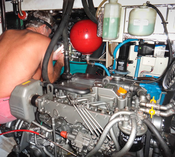
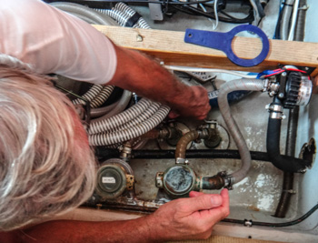
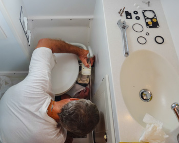
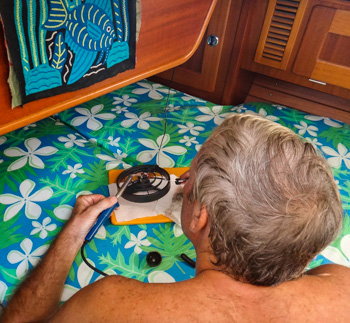
Jim brought the dead fan above our bed back to life with a new switch, fished out the slimy intruder who managed to swim up into the toilet pump and stop it cold, bypassed something in the watermaker to allow it to keep working and finally gave up on the generator because the problem appears to be in the computer board. Boats. Sometimes they are loads of fun.
Our route would take us due west until we reached the Philippines, then through the Hinatuan Passage just north of Mindanao. If we could average 5 knots, we would time the tide right to pass through the Hinatuan Passage easily. If we got it wrong, we could be fighting up to an 8 knot current.
After sailing through the Visayas we would cross the Sulu Sea then turn left beyond the tip of Borneo and sail down into the South China Sea to Kota Kinabalu.
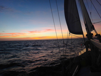
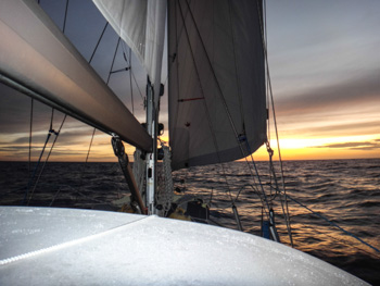
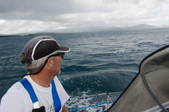
The anchor was up at 11:25 am on January 31 and we were in the West Pass by 2:00 PM. A lot of current and one meter swells threatened to take Tenaya on a wild ride but Jim kept her steaming towards the open ocean.
Winds were light from behind and seas were moderate as we sailed through the first night under a tiny sliver of the moon. The following day the sea dropped to slight. We motored more than sailed to keep our speed up the next four days.
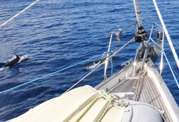
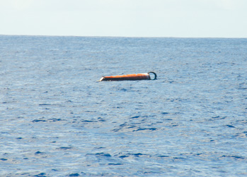
Dolphins came to visit and we passed numerous bits of trees and a few FADs, (Fish Aggregating Devices) along the way. These big, unlit, metal drums could do some serious damage if hit. We tried to fish but didn't catch anything.
An hour before dawn on Day 5 we were approaching the northern coast of Mindanao. I was on watch and had identified a light off in the distance as AIS target Ocean Explorer. It had a CPA (Closet Point of Approach) of 8 miles so I wasn't worried. I was stretching with my back to it and thought I heard voices. I stood up to look around and there was an open boat right next to us! I could see several men just a few feet from Tenaya. "Jim!" I said in a slightly panicked voice loud enough to wake him. "JIM!" I turned to starboard, pushed the throttle and steered away. Our insurance agent had clearly explained that we were not insured for pirates even though we paid extra to sail through the Philippines.
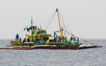
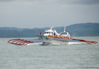
As dawn broke I saw the boat about a half mile away. It had a long, narrow hull with outriggers on each side and a noisy engine. I hadn't been listening to my iPod, why didn't I hear the engine earlier?
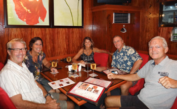
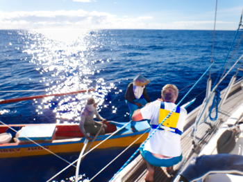
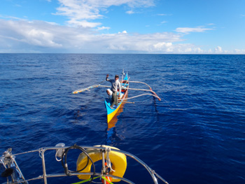
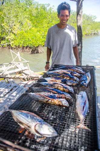
About noon a smaller boat came near. The two guys' faces were covered with fabric. Only their eyes were visible under wide conical hats. We remained calm as they approached Tenaya. We waved, they waved. Then they said, "Fish, fish?" We said, "No thank you, we have no pesos." They didn't understand English and showed us a nice tuna. Oh yeah, we wanted that! Their fishing skills were better than ours. I gathered a litre bottle of cold water, a can of candy and two US dollars and held them up. They took off their masks, smiled and paddled close enough to make the exchange. They couldn't have been more than 18 years old and were very happy with the trade. Definitely not pirates, and thanks to them we had sashimi for dinner.
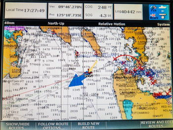
On February 4 we slowed the boat down to 3 knots to motor through the islands and set ourselves up for the Hinatuan Passage. Squalls passed overhead and added to the tension. At 0409 Jim wrote in the log: Floating stuff in water but too dark. Hit something - log stopped working.
It was important to be at 09* 45'.72N 125* 41'.85E 3-3.5 hours before High Water Surigao and we timed it right, arriving at 1030. We went through the narrowest section with the flood. Although our boat speed was 3.0 knots, we were doing 6.1 SOG (Speed Over Ground) as the water swirled around us. By 1500 we were clear and could put the sails up and turn off the engine. How sweet that was!
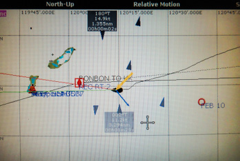
We sailed beneath Bohol towards Negros and dodged ferries and big ships as they made their way to and from Cebu. The ships blended in with the lights on shore. The chartplotter startled me when it beeped 'Dangerous AIS Target.' I couldn't see it at first but, when I expanded the screen, it appeared. It was hidden behind the text labeling all the waypoints into the river. Yikes, that was a first.
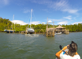
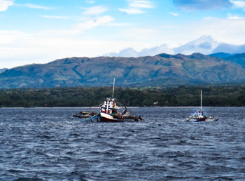
We sailed slowly to kill time until dawn on Day 7. Then Jim guided Tenaya up the river to Bonbonon.
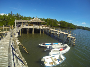
Bonbonon - 09 03'.44N 123 07'.53E
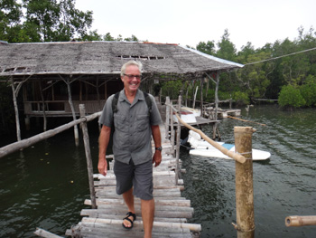
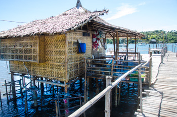
What a great decision to stop at Pt. Bonbonon! Besides getting fuel and sleeping through the night in this safe, pretty and protected anchorage, we met some really nice people.
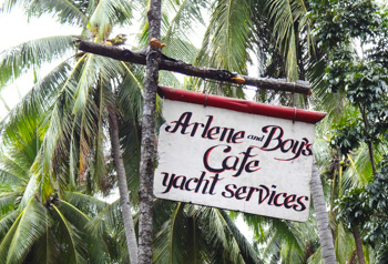
Yachtie's information:
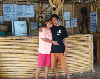
Arlene's family has been helping cruisers here for over 20 years. Now she and her husband, Boy, run the business. They offer moorings for 50 pesos per day, about $2USD. Sticky mud makes a mess of the deck so it's a good idea. Just tie up to the white guest buoy in front of their place which is the second set of stilt houses on the left inside the anchorage. It won't be long before one of them comes to greet you and directs you to a mooring.
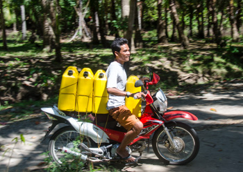
Boy will fill fuel cans and they prepare a fabulous Friday night buffet for 190 pesos ($7USD). They also offer haul-out services for up to 2.5 meter draft for 300 pesos a day ($10USD). Workers can be hired for 50 pesos an hour.
The closest town is Dumaguete, a haven for retired American men with local wives half their age, maybe younger. Most everything is available in this affluent town and prices are low. Flights to Cebu and Manila run daily and there is a decent hospital here.
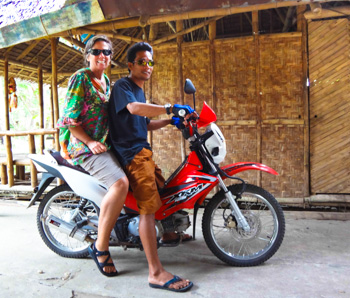
People in the Philippines have mastered the art of transporting the greatest number of people on the fewest number of wheels. So Boy thought nothing of suggesting Jim and I hop on the back of his motorcycle for a ride to the highway to catch the bus into town. Mind you, Filipinos are small. Jim and I are not. But Filipinos are extremely hospitable and Boy was determined to get us to the bus. He climbed on, then me, then Jim. He pointed to small pegs on either side to put our feet on. As we bounced and swerved down the dirt road, Jim slid into me as I pressed into Boy's back. All the time we both tried desperately to keep a small part of each foot on the pegs we shared. I'm not sure who was more relieved when we finally reached the bus stop.
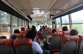
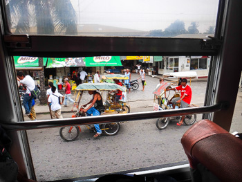
The bus ride to town took about an hour and cost 50 pesos. We got off at Robinson Mall which has an ATM, supermarket, Globe SIM cards that work in the anchorage, a Do-It hardware store and two floors of retail shops all chilled by glorious air-conditioning. On the way back we sprung for the extra 10 pesos and climbed into an air-conditioned bus.
Two nights in the Philippines were our limit as we were in a hurry to get to Borneo. It's too bad because Arlene, Boy and the other yachties are all really nice and it was a pleasant place to stay with fun kayaking among the small moored fishing boats down the river.
Arlene and Boy can be reached at nearne@yahoo.com or +63 (0)9173612437.
We left Bonbonon on February 9 with 20-28 knot winds gusting over 30. Perfect downwind sailing! All was great for 12 hours until it dropped to 10-13 knots. Then it died. Back to motoring. 12 hours later it was back in the double digits so we could motorsail. A band of clouds appeared on the horizon indicating we'd reached the ITCZ. We hate going through these things because it usually means lightning. Lightning scares us.
We were moving through the reef-studded Sulu Sea in the recommended shipping route but didn't see many ships until we got close to Borneo. Then a steady stream was heading either north or south along that island's eastern coast, bound to or from Australia. At one point we were headed directly for a reef that an American Navy ship went aground on last year. That made us nervous because it was dark.
The narrow passage between southern Palawan and northern Borneo is called the Balabac Strait. It's full of big ships as China, Japan and Korea are to the north and Singapore and the Malacca Strait are to the south. Some of these ships are bigger than anything in the Pacific because they do not need to fit in the locks of the Panama Canal.
On February 13 we arrived in Kota Kinabalu, the capital of Sabah, Malaysia, on the northwestern side of Borneo. Borneo is the third largest island in the world. The lower 73% is called Kalimantan and belongs to Indonesia. The upper portion is Malaysian, split into states, Sabah and Sarawak. Tiny Brunei is nestled in a crook of Sarawak. Oil drilling platforms dot the coast and oil palm plantations blanket the island. Borneo is home to orangutans, proboscis monkeys, pygmy elephants, hornbills and many, many more creatures. We couldn't wait to get started exploring!
We thank the crews of Matsu and Pelagic for their help and suggestions for plotting our route. It was hard for Jim to gather all the information needed to connect the dots so he will post it on Noonsite for anyone else considering sailing from Palau to Kudat or Kota Kinabalu.